|
|

|

Tutorial Home | Site Map | Glossary | GEOSS URR | GEO |
|
| Risk-Based Planning: Starting Extending Adding Details Hazard Assessment Vulnerability&Assets | Previous Next |
|
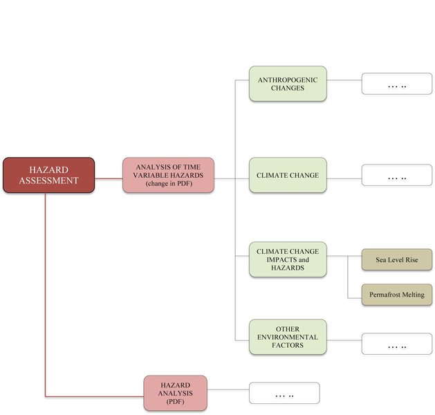
Hazard Assessment The sketch on the left shows a top-down analysis of the application hazard assessment. The input for the assessment is the result of a detailed hazard analysis, which ideally provides maps of hazard intensities and probabilities (probability density functions). The application hazard analysis in turn depends on many observations. In most cases, the requirements for hazard analysis can be broken down into more applications and requirements. The sketch shows at the bottom such a break down for the pollution source requirement. Currently, hazard analysis mainly takes a static view in the sense that hazard PDFs do not change significantly over time. However, for a number of hazards, climate change and other anthropogenic changes to the Earth system likely will impact the PDFs significantly. Therefore, the application hazard assessment also includes in the next level the application analysis of time variable hazards, which looks at climate change and hazards (e.g., the change in storms, floods, droughts, heat waves, etc.), climate change impacts and hazards (e.g., the effect of sea level rise on coastal flooding and the changes in landslide probability due to permafrost melting), anthropogenic changes and hazards (e.g., the change on landslide probability caused by changes in land cover or construction of infrastructure), and other potential environmental factors (e.g., the effect of the loss of mangroves and wetlands on coastal flooding). |