|
|

|

Tutorial Home | Site Map | Glossary | GEOSS URR | GEO |
|
| Early Warning: Starting Extending Adding Details Completing Analysis | Previous |
|
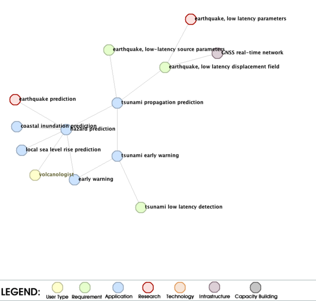
Analyzing the Local Environment The current version of the graphical interface allows a basic analysis of a local environment. Several analysis examples are discussed in the Analysis Examples tutorial. In the example shown to the left, we used the graphics for the application early warning, and we clicked on the symbol for hazard prediction. This makes hazard prediction to the center of the environment. We see now that the sub-applications of hazard prediction are far from complete. For several of the available sub-applications, research needs are identified. Compared to the graphics shown in the previous screen, the user type volcanologist display now several applications, research needs, infrastructure needs, and requirements that were not shown earlier. The reason is that early warning and volcanologist have a link level of two, while volcanologist and hazard prediction have a link level of one. As a next step, we make tsunami propagation prediction to the center of the graphics. We now 'discover' the research need and infrastructure need connected to the requirement for low latency earthquake displacement field. However, we have to note here that the requirements, research needs, infrastructure needs and capacity building needs for the overall tsunami early warning complex are not complete yet, and the current graphics can be used to identify the missing bits and pieces. |